
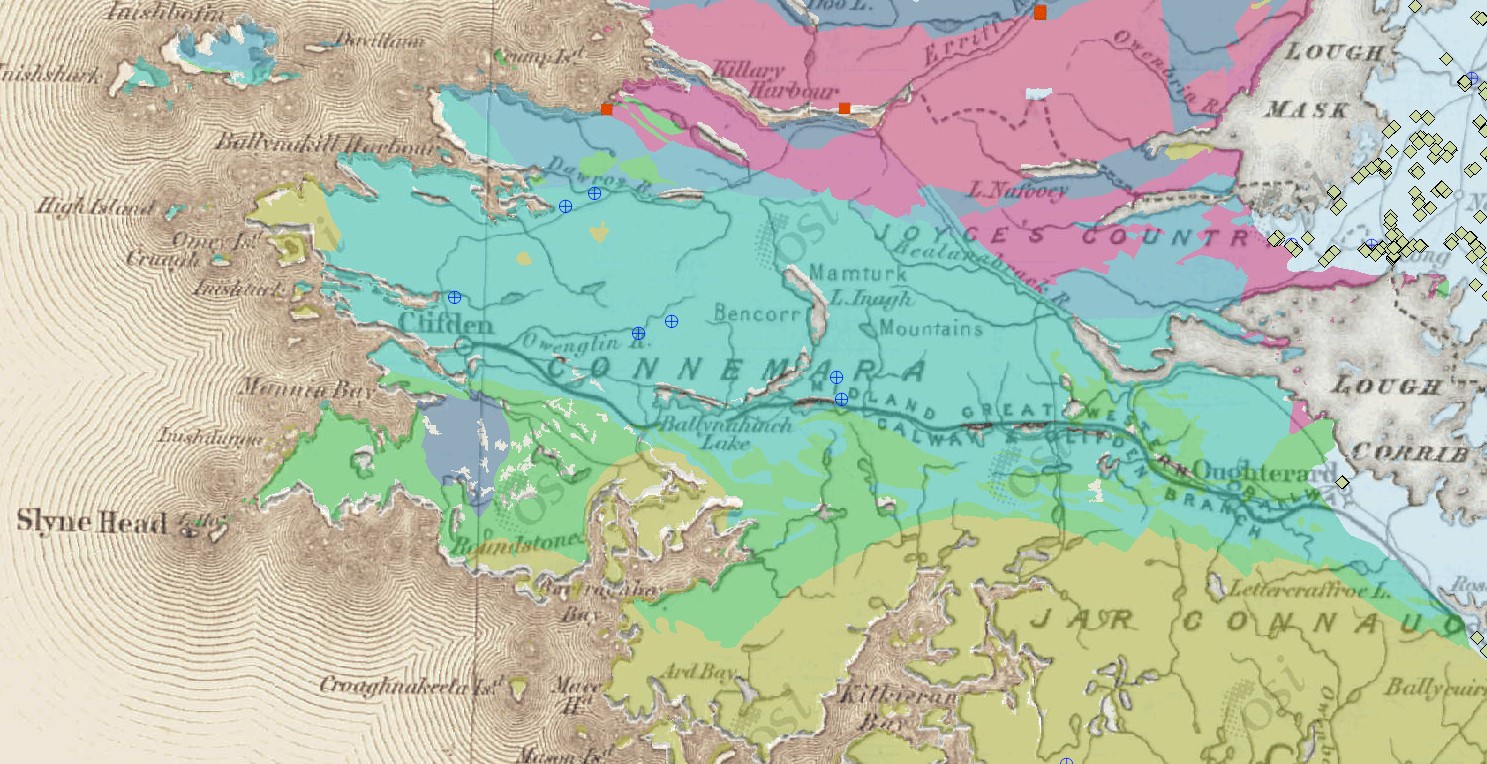
Oughterard on a Geological Frontier
Oughterard lies on a geological frontier. Visitors leaving on the Clifden road can hardly fail to notice that the scenery before them is strikingly different from that on the eastern, Corrib side of the village. This change, which is directly related to the nature of the under lying rocks, occurs along an irregular line which runs roughly from near Cong to Galway, skirting the western side of Oughterard. To the west of the line are exposed metamorphic and igneous rocks extending into the mountains of Connemara: to the east lies the central plain of Ireland underlain mainly by limestone.
The Ancient Rocks of Connemara
The ancient rocks of Connemara represent several phases of rock formation, deformation, uplift and erosion. The oldest are known as Dalradian series because of their resemblance to rocks of similar age in Scotland. Originally laid down as sediments (sands, muds and calcareous deposits) between 700 and 600 million years ago, they were transformed into metamorphic rocks (quartzites, micaschists and marbles) by heat and pressure deep in the earth’s crust and were deformed by folding and fracturing. In the present day countryside of Conneamra the highly resistant quartzites generally form the mountains, particularly the Bens and the Maamturks, where as the more easily eroded micaschists and marbles tend to occupy the lower ground. While still deep in the crust these metamorphic rocks were intruded by molten-rock which crystallized slowly to form granite, notable that which now outcrops to the west and north of Oughterard.
Ordovician and Silurian Period (500-400 million years ago)
All these ancient rocks were then uplifted into mountains, which were eroded deeply before the next major rock-forming phase, occurred during Ordovician and Silurian times (500-400 million years ago). The sands and muds, which were then deposited under marine conditions, were subsequently consolidated into sand stones and mudstones. In the immediate neighbourhood of Oughterard this series of rocks is poorly represented (only a small patch along the Glann Road), but they now form part of most of the hills on the eastern side of Maam Valley extending into Murrisk. Further earth movements deformed and uplifted these rocks and more granite masses (the Galway granite, for example) were intruded at depth. Erosion, over long periods of time, then carved them down to a level not so very different from what we see in Connemara to day.
Carboniferous Period (350 million years ago)
It was upon this surface that more sediments were deposited some 350 million years ago, during the Carboniferous period. There is a clear record of these rocks in the Oughterard area. The first deposits are sandstones, which probably preceded the incursion of the sea. These can be seen in small exposures at Derylaura and Tonwee, where they over lay the old land surface of Oughterard granite, and also on the Island of Inchagoill. The sandstones are followed by a thick succession of limestones, which were laid down in the shallow Carboniferous sea. These underlie most of Oughterard and stretch across the Central Plain to Dublin. Several varieties of limestone are exposed in or around Oughterard in the riverbanks, the road cutting on the Galway road, along the Cregg ridge and along the lakeshore.
These rocks are commonly fossiliferous with many shells and some quite large corals. Some of the corals have had their originally calcareous skeletons replaced by quartz. This mineral is much more resistant to weathering than limestone so the corals stand out in relief on the naturally weathered surfaces. Good examples can be seen in places along the lakeshore when the water level is low enough.
Subsequent doming of the Connemars area, followed by erosion, led eventually to the present day topography.
Sharp Scenic Divide at Oughterard
The sharp scenic divide, on which Oughterard lies, is particularly abrupt here because the contact between the limestone and the ancient metamorphic and igneous rocks occurs along a fault. This fracture of the earth’s crust (long since healed) extends from the west side of Oughterard in a straight line through Moycullen to Galway. The east of the fault the limestone beds are usually fairly flat lying, but near the fault they have been locally tilted up.
Flat-lying beds can be seen outcropping in the Owenriff riverbank, near the main road bridge by the church, while tilted beds form the waterfall further to the west. The fault itself, marked here by the contact between limestone and granite, lies close to the footbridge crossing the river just upstream from the waterfall.
Ice Age Glaciations
The most recent geological events to leave an obvious mark on the countryside around Oughterard are those of the Ice Age glaciations which occurred merely a few tens of thousands of years ago. Central Ireland has a wide range of textbook examples of glacial deposits. Of these the most evident around Oughterard are the drumlins. They are prominent, rounded hills, often oval in plain view, formed of unconsolidated, gravelly sediment. There are obvious ones at Tonwee, and many form islands in Lough Corrib.
Alan Lee was professor of Geology at Louvain University, Belgium, and has spent many summers with students studying rock formations in Connemara, He is now retired and living in Knockferry.
“Oughterard Newsletter” June 1998


No Comments
Add a comment about this page