Porridge Town West
David Collins

Townland and Description : Porridgetown East, Cnoc Bracháin. Hill of the pottage
Porridgetown West is in the civil parish of Kilcummin. The civil Parish corresponds with the following Church of Ireland parish of Kilcummin, Galway West. In general, the civil parish and the Church of Ireland parish are the same as is the case in the Kilcummin Oughterard area.
Other Names:
Porridgetown West
Porragestown County Map
Poragetown County Registry 1820
Porridgetown W. High Constable for the Barony
Knockbroughane Printed Townland List
Knockbrohane Quit Rent Ledger
Knockbrackan Robt. Martin, Esq., Ross
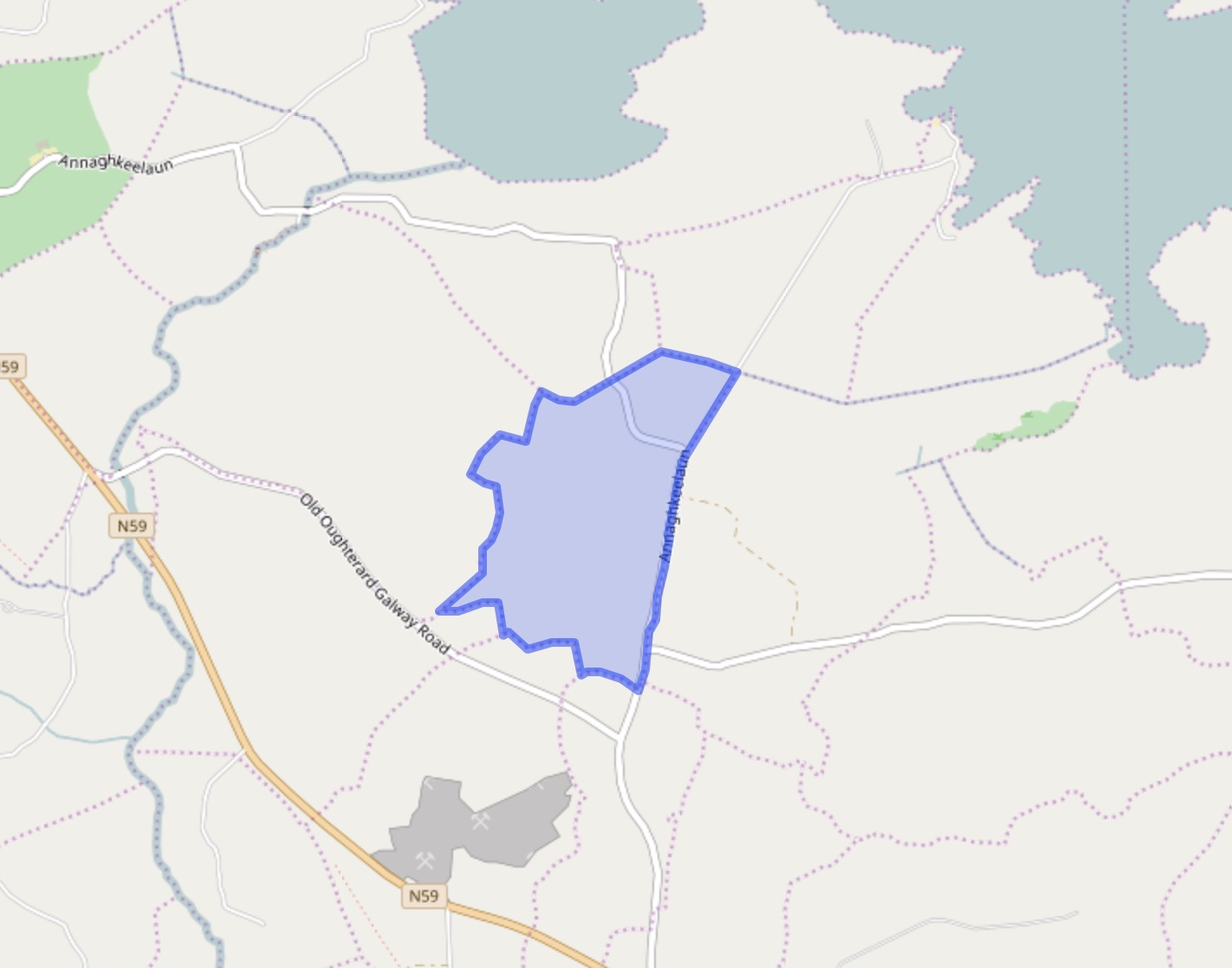
Porridgetown West Sketch Map
Porridgetown W. Thos. Martin, Esq., M.P.
Down survey 1641-1670:
The Down Survey is a mapped survey. Using the Civil Survey as a guide, teams of surveyors, mainly former soldiers, were sent out under Petty’s direction to measure every townland to be forfeited to soldiers and adventurers. The resulting maps, made at a scale of 40 perches to one inch (the modern equivalent of 1: 50,000), were the first systematic mapping of a large area on such a scale attempted anywhere. The primary purpose of these maps was to record the boundaries of each townland and to calculate their areas with great precision. The maps are also rich in other detail showing churches, roads, rivers, castles, houses and fortifications. Most towns are represented pictorially and the cartouches, the decorative titles, of each map in many cases reflect a specific characteristic of each barony. (http://downsurvey.tcd.ie)
The down survey website will tell you who owned this townland in 1641 (pre Cromwell) and in 1671 (post Cromwell).
The Tithe Applotment Books
About the Records
Tithes were a tax on agricultural produce which was payable by the occupiers of agricultural land. They were the main source of income for the parish clergy of the Church of Ireland (the largest Protestant church and the church established by law). However, in many parishes a large part of the tithes was ‘appropriate’, which meant that they were payable to a bishop, cathedral chapter or another ecclesiastical recipient, or were ‘impropriate’, which generally meant that they were payable to a local landowner. The parishes used in the Tithe Applotment Books are civil or Church of Ireland parishes, which often differ in name and territory from Catholic parishes, Acts of Parliament of 1823 and 1832 provided for the conversion of tithes into a fixed charge on land, and specified the average price of wheat or oats in the parish in the seven years before 1821 as the basis on which the tithes would be calculated. They also extended the application of tithes to pasture, where previously they had been levied only on tillage.
This change in the law resulted in the valuation of individual holdings in almost all parishes containing agricultural land, in order to assess the portion of the tithes for which each occupier of land would be liable. The apportionment was recorded for each Church of Ireland parish in a Tithe Composition Applotment Book. The information was collected and the amounts were calculated by two Parochial Commissioners, one of whom was appointed by the cess-payers of the parish and the other by the relevant Diocese of the Church of Ireland. This procedure was carried out in over 2,500 parishes between the years 1823 and 1837.
The Tithe Applotment Books are in a variety of formats, from a few pages sewn together to elaborately bound volumes. In most cases they are written in manuscript throughout, although some consist of manuscript entries on printed questionnaires. The information in the books is broadly uniform and generally includes at least the name of occupier; the size of holding, the valuation and the tithe payable. In some cases, more detailed information is provided. Some volumes have maps and most have certificates and correspondence attached.
The sub-divisions of the parish were recorded. Some of these subdivisions, such as plough lands, ceased to be in official use after the six-inch survey of the Ordnance Survey was completed in the 1840s. Only productive land was subject to tithe, and the books usually distinguish between this tithable land and untithable land such as roads or mountains. Tithable land was in some cases classified by quality, and a money value was given to each class. In some cases, the proportion of tithe payable to the rector, vicar or lay proprietor of the tithes was set out. The column for observations was sometimes completed, with information about commonage, for example.
There are a number of other points that should be noted. The acreages given in the Tithe Applotment Books are in Irish or Plantation measure, which is 1.62 times larger than statute measure. Only occupiers of land at the time of the tithe composition are recorded, so not all heads of households living in a parish at the time are included. Only rural areas are systematically covered, although inhabitants of towns who held plots of cultivable land are included. The equivalent tax in urban areas, Minister’s Money, has left few records.
The Tithe Applotment Books are an important source of information for a wide variety of researchers of pre-Famine Ireland. They provide the first surviving national list of the occupiers of land, and are used by genealogists as a partial substitute for returns of the 1821 and 1831 censuses of population, which were destroyed in 1922. They also record information on the quality of land, and provide information on pre-Ordnance Survey territorial divisions, some of which were not recognized after the 1840s.
The National Archives hold the original Tithe Applotment Books only for the twenty-six counties of the Republic of Ireland. The books for the six counties of Northern Ireland are held in the Public Record Office of Northern Ireland in Belfast. (http://titheapplotmentbooks.nationalarchives.ie/search/tab/aboutmore.jsp)
Census 1821/1831:
Population of Kilcummin Parish
1821: 8,099. 1831: 9,848
Census 1823:
Population of Kilcummin Parish
1,092 Houses. 6,219 souls
O’Donovan field names 1840
Proprietor: Chris O’ Flaherty
| Landlord | Townland | Civil Parish | Area | Land Value | Building Value | Total Value | ||||||||||||
|---|---|---|---|---|---|---|---|---|---|---|---|---|---|---|---|---|---|---|
| A. | R. | P. | £. | s. | d. | £. | s. | d. | £. | s. | d. | |||||||
| O’Flaherty, Chris | Porridgetown East | Killannin | 240 | 0 | 8 | 80 | 8 | 0 | 0 | 0 | 0 | 80 | 8 | 0 | ||||
| Total | 240 | 0 | 8 | 80 | 8 | 0 | 0 | 0 | 0 | 80 | 8 | 0 | ||||||
Census 1841-1851:
Griffiths Valuation 1855:
All the land {a.135. r.0, p.0} is is recorded as being owned byThe Law Life Assurance company Ltd
Tenants: James Dunne
Census 1891:
Census 1901:
| 1 | Melia | View occupants or original census form (as a PDF) |
Census 1911:
| 1 | Walsh | View occupants or original census form (as a PDF) |
| 2 | Darcey | View occupants or original census form (as a PDF) |
| 3 | Mealia | View occupants or original census form (as a PDF) |


Comments about this page
Porridgetown West is in the Civil Parish of Killannin.
Ref. General Alphabetical Index to the Townlands and Towns, Parishes and Baronies of Ireland – Based on the Census of Ireland for the year 1851.
Griffith’s Valuation shows the area to be 135 acres, 2 roods and 24 perches. Property was held by the Directors of the Law Life Assurance Company and the tenant was a James Dunne.
By a Deed of Release dated 4th August 1777 Jasper Martin of Ross and his only brother Nicholas Martin of Ross entered into a Settlement in relation to a number of townlands one of which was Knockbrackane, otherwise known as Porridgetown.
Other names in the Settlement were: James O’Hara, the Elder of the town of Galway, Geoffrey O’Hara of Lee Garden in the County of Essex in the Kingdom of Great Brittain, Elizabeth O’Hara, Spinster, the eldest daughter of the said James O’Hara and niece of Geoffrey, James O’Hara, the Younger of the City of Dublin, Michael Daly of Loughrea, Robert O’Hara of Galway City and Robert Shaw of Clostoken.
Witnesses: Thomas Martin of Pullagh
Francis Martin of the Abbey in Galway
Jim Fahy
12/10/2016
Add a comment about this page