Magherabeg
Townlands of Oughterard
By Paul Gibbons

Anglicized from Irish: An Machaire Beag
Translates to: “The small plain”
Etymology:
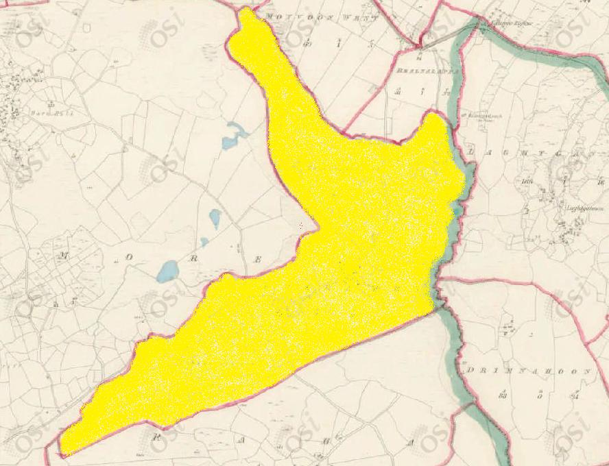
This placename is fairly straight forward as Magherabeg is a relatively flat area of land of just over 218 acres. This is considered ‘small’ in relation to its neighbouring Magheramore. In fact, the two only seem to be separated because a low hill ridge divide the two flat plains.
Size: 218 acres, 2 rods, 0 perchs
Siting:
In the eastern extremity of Kilcummin parish. Bounded on the north by Gortrevagh, Moyvoon West, and Bealnalappa on the east by Killannin Parish (Laghtgannon and Drimnahoon), on the south by Raha and on the west by Magheramore.
Description:
Land good. Contains 218 and a quarter acres of land about half of which is under tillage. There is half an acre of water, the remainder is mountain pasture, there is nothing remarkable in this townland.
Placenames within townland:
Knockaunnagark – Translates to ‘hill of the hens (grouse)’. A very high hillock on the south side of the townland.
Magherabeg Bridge – An old bridge linking the townlands of Magherabeg and Moyvoon West.
Previous proprietor/landlord:
Earl of Clanrickard (1641)
Earl of Clanrickard (1670)
Thomas B. Martin of Ballinahinch Castle (c. 1850)
Land Value (1857): £ 40 s.0 d. 9
Buildings Value (1857): £ 4 s.0 d. 0
Surnames attached to the townland (1857-1911):
Burke, Walsh, Feenaughty/Finnerty, Downey, McDonough/McDonagh


No Comments
Add a comment about this page