Dog Island
Antoinette Lydon

Dog Island is in the civil parish of Kilcummin. The civil Parish corresponds with the following Church of Ireland parish of Kilcummin, Galway West. In general the civil parish and the Church of Ireland parish are the same as is the case in the Kilcummin Oughterard area.
Information from O’Donovan’s Field Name Books
Parish: Kilcummin
View all place names in this civil parish.
Other Forms of the Name with the authority source (if provided) in italics.
Dog Island Local
Dog Island is in the Electoral Division of Turlough, in Civil Parish of Kilcummin, in the Barony of Moycullen, in the County of Galway
The Irish name for Dog Island is Oileán an Mhada
Area:
A small island containing 1½ acres. It is situated on the South side of Lettermullen Island.
http://places.galwaylibrary.ie/asp/fullresult.asp?id=54520
Other placenames in this townland:
Some other placenames in or near this townland are …
- Dawseys Rock (rock)
- Dog Island Rock (rock)
Information from the Down Survey Website:
The Down Survey website will tell you who owned this townland in 1641 (pre Cromwell) and in 1671 (post Cromwell).
Poor Law Union Ireland
In Ireland the Poor Relief Act of 1838 divided into districts or “unions” in which the local taxable inhabitants were to be financially responsible for all paupers in the area. In 1898 the Poor Law Union was adopted as the basic administrative division in place of the civil parish and barony. Further subdivision into 828 registration districts and 3,751 district electoral divisions followed. Townlands were not arranged according to these divisions with parish and barony retained as a means to make comparisons with records gathered before 1898.
The 1838 Act
The main provisions of the 1838 Act were:
- The extension of the existing Poor Law Commissioners’ powers to Ireland, with the appointment of Assistant Commissioners who were to implement the Act in Ireland.
- The division of the country into Poor Law Unions based on Irish electoral divisions which were made up from townlands.
- The creation of a Board of Guardians for each Union, two-thirds of whom were to be elected, the other third to be appointed ex officio.
- The setting up of a workhouse in each Union.
- The collection of a local poor-rate to finance the system.
- Assistance for emigration.
Initially, 130 Unions were created, based upon 2,049 electoral divisions. The divisions were composed of townlands, a peculiarly Irish unit, traditionally of 120 Irish acres in area. (Between 1848 and 1850, an additional 33 Unions were created by subdividing and reorganizing the boundaries of some existing Unions, particularly in the west of the country.
Boards of Guardians were elected annually on 25th March. Only rate-payers were eligible for election, which effectively disenfranchised most of the native Irish who were usually tenants at this time. Rate-payers were allowed between one and six votes depending on the size of a valuation of their property.
Griffith’s Valuation:
Dog Island had an area of 4 acres, 1 rood & 36 perch. The Land Valuation was £1 5s 0d. No Buildings on the Island.
Occupier: Tenants of the townland of Roskeeda.
Immediate Lessor: Directors of the Law Life Assurance Company.
http://www.askaboutireland.ie/griffith-valuation/index.xml?action=doNameSearch&PlaceID=560521
Population and Census Information:
People who lived here:
You can retrieve a list of people who lived in this townland from 1827 to 1911. This list is compiled from the following resources.
- The Tithe Applotment Books
- Griffith’s Valuation
- 1901 Census
- 1911 Census
List of nineteenth century and early twentieth century inhabitants.
Census 1841-1911
No people lived on Dog Island.
Townlands
A townland is one of the smallest land divisions in Ireland. They range in size from a few acres to thousands of acres. Many are Gaelic in origin, but some came into existence after the Norman invasion of 1169
Dog Island is a townland.
Church records of births, deaths and marriages:
Church records of births, deaths and marriages are available online at http://www.rootsireland.ie. To search these records you will need to know the ‘church parish’ rather than the ‘civil parish’. (The civil parish is the pre-reformation parish and was frequently used as a unit of administration in the past.)
Dog Island is in the civil parish of Kilcummin.
Catholic parish:
This civil parish corresponds with the following Roman Catholic parish or parishes.
- Clonbern & Kilkerrin in Galway East.
- Carraroe in Galway West.
- Kilannin in Galway West.
- Kilcummin/Oughterard in Galway West.
- Rosmuc in Galway West.
Church of Ireland parish:
This civil parish corresponds with the following Church of Ireland parish.
- Kilcummin in Galway West.
In general, the civil parish and the Church of Ireland parish are the same, but, this is not always the case.
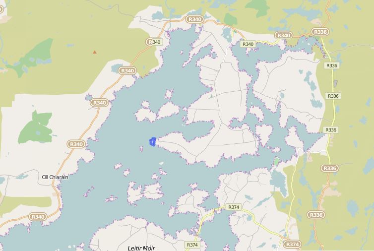
Maps
It is located at 53° 20′ 25″ N, 9° 40′ 4″ W.
Original OS map of this area
Ireland was first mapped in the 1840s. These original maps are available online.
Original OS maps at the Ordnance Survey of Ireland website
Below is a link to the Ordnance Survey of Ireland website. It displays the original OS map that was created in the 1840s.
Information from Google Maps:
You can use this link to find this townland on Google Maps.
Google Maps
Information from the National Monuments Service:
You can use this link to view a map of archaeological features. This link brings you to a website wherein you will have to search for your townland.
Archaeological map from the National Monuments Service


No Comments
Add a comment about this page