Cloghermore
Townlands of Oughterard
By Paul Gibbons

Anglicized from Irish: An Clochar Mór
Translates to: “The large Stony Place”
Etymology:
The origins of this placename are straight forward coming from the topography of the area. The townland is further west than most of the other land in the Oughterard region and hence has shifted from the reasonably fertile land close to Lough Corrib to the more barren, stone-filled bog and mountain pastureland of the Connemara region. This is evident in the fact that of the large 1958 acre area very few families seem to have lived there with only 10 acres under tillage or pasture in the 19th century.
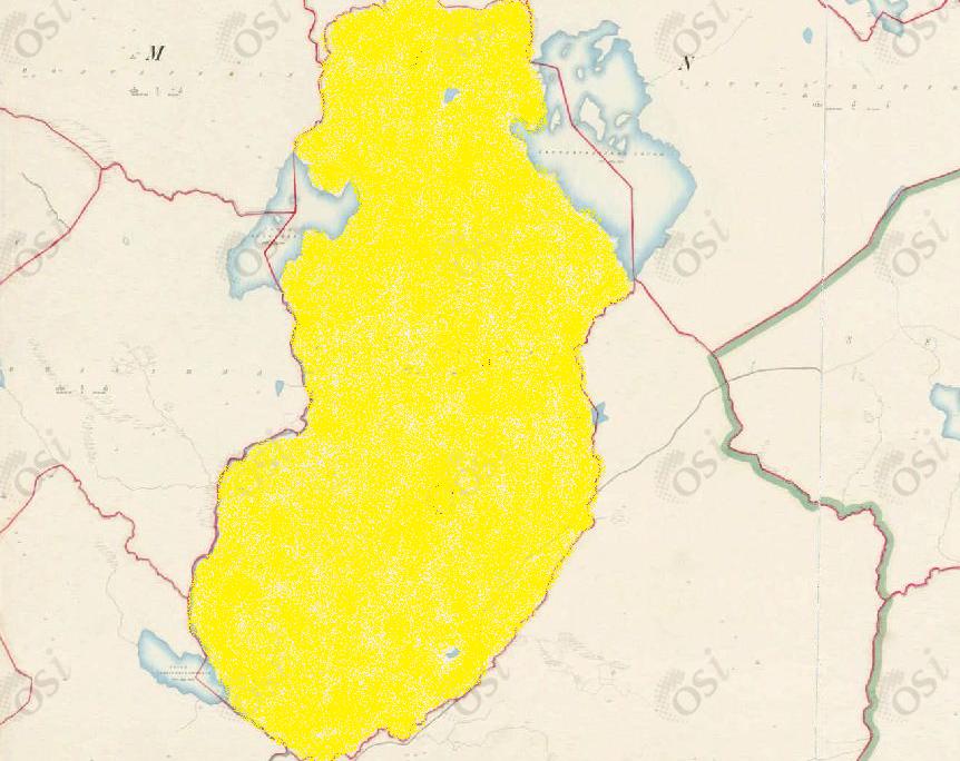
Size:1958 acres, 0 rods, 23 perchs
Siting:
In the eastern extremity of Kilcummin parish. Bounded on the north by Shannadullaghaun, on the east by Lettercraffroe, on the south-east by Shannapheasteen and on the west by Lugganaffrin, Lugganimma and Formweel.
Description:
Contains 1958 acres about 10 acres are under tillage and pasture, a futher 124 acres consist of water, the remainder is mountain. Lettercraffroe Lough with its islands, two of which belong to this townland, forms part of the eastern boundary.
Placenames within townland:
Loughaclougher (lake) – Translates to ‘lake of the stony place’. A large lough containing 72 and three quarter acres. There are 9 islands in it, the largest three of which belong to Lugganimma, the next largest to Lugganaffrin, the remainder to Cloghermore. It is half a mile west of Lettercraffroe Lough.
Loughcallanatrush (lake) – A small lough containing 2 acres. About a half mile south of Lettercraffroe Lough.
Previous proprietor/landlord:
Thomas B Martin of Ballinahinch Castle (c. 1850)
Land Value (1857): £10 s.15 d.0
Building Value (1857): £0 s.5 d.0
Surnames attached to the townland (1857-1911):
Whitaker, Keady


Comments about this page
Cloghermore Townland: Tithe Records taken in 1829 show “Cloughermore (Mount) to be the property of Thomas Henry O’Flaherty. A Francis Flaherty is shown to be occupying 4 acres of 2nd class land, 800 acres of 5th and 500 barren acres classified as bog of no value. A Patt Hynes and Co. are shown for a Mill Plot of 1 acre, classified as 2nd. Census for 1841records one occupied house with 4 male and 4 female occupants; Census for 1851 records only 3 female occupants. Poor Law Valuation £8.0.0. Griffith’s Valuation records Rev. Charles Whitaker as owner occupier of herds house and townland. Census for 1901 records Michael Keady as Herd and the land owner – John Walsh. Michael Keady his wife Mary and children: Norah, Daniel, Martin, Sarah and James are occupying one house while two other houses are described as “Shooting Lodges” owned by Henry Hodgson. Michael and Mary Keady would appear to be the same as Michael Keady, 21 years of Ballinahown and Mary Folan of Minna, 21 years who married in Spiddal Church on October 3rd 1875. Possible family connections: Conneely’s of Seecon. There is no record in the 1911 census for Cloghermore.
Add a comment about this page