Canrawer East
Townlands of Oughterard
By Paul Gibbons

Anglicized from Irish: Ceann Ramhair Thoir
Translates to: “Thick headland of the east”
Etymology:
A headland is a point of land, usually high and often with a sheer drop, that extends out into a body of water. This perfectly describes this townland’s topography as Canrawer commands a high position over the land further west with a sheer drop down to the Fough/Owenriff river. The term ‘thick’ may be a hint that the area was once a heavily wooded thicket. The fact that many large trees which date back a few hundred years still exist in the area lends credit to this theory.
Size: 14 acres, 3 rods, 33 perchs
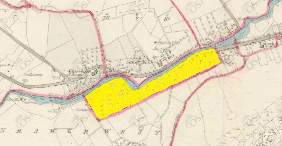
Siting:
In the northern extremity of the parish. Bounded on the north by Carrowmanagh; on the north-west by Clare and Claremount; on the south-west by Cregg and on the south-east by Canrawer West.
Description:
Good quality land all under plantation. A herder lives in it to herd for the village. There is a Roman Catholic Chapel together with the residence of the Rev. P.W. Kirwan P.P., both situated in the eastern part of the townland.
Placenames within townland:
Church of the Immaculate Conception (church) – Roman Catholic church originally designed by William Brady in an early gothic style. It was reconstructed and extended from 1932-34 after a fire.
Cushmeagnacally (rock) – Translates to “the hag’s step”. A rocky passage through the river Fough near the spa well in Clareville Demesne. Said to be the passage of a witch chased across that place by Remon an Urla.
Previous proprietor/landlord:
Earl of Clarickard (1641)
Earl of Clarickard (1670)
Captain O’Flaherty of Lemonfield (c. 1850)
Land Value (1857): £5 s.0 d.0
Buildings Value (1857): £22 s.5 d.0
Surnames attached to the townland (1857-1911):
Martin, Kavanagh, Davis, Faherty, Naughton, Phillips, Walsh, McDonagh, Conneely, O’Brien, Clancy, Keeley, Butler, Connor, Dillon, Gill, Grogan, Sullivan


No Comments
Add a comment about this page