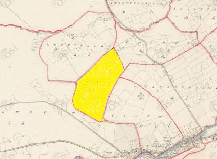
Tonweeroe
Townlands of Oughterard
By Paul Gibbons

Anglicized from Irish: An Tóin Buí Rua
Translates to: “The red yellow bottomland”
Etymology:
This placename like most other townland names is a physical/visual description of the area. Here Tóin which means bottom can be translated properly as ‘bottomland’. This is low-lying land, typically by a river which is quite an apt description of Tonweeroe given its proximity to the Owenriff/Fough river and its elevation compared to the land further north (Newvillage, etc). The term red yellow may be a reference to a crop that was sowed in the area or the type of soil that was present. This soil type explanation is most likely given the neighbouring townland of Tonwee, ‘the yellow bottomland’. Soil color is influenced by the amount of proteins present in the soil and yellow or red soil indicates the presence of iron oxides.
Size: 49 acres, 0 rods, 34 perchs
Siting:
In the northern extremity of Kilcummin parish. Bounded on the north by Derrylaura and Tonwee, on the east by Carrowmanagh and Clare, and on the south and west by Claremount.
Description:
Contains 49 and a quarter acres about 20 acres of which is arable land, the remainder is bog. Tonnweeroe means a yellow and red mixture of earth or clay, at the base of a hill.
Placenames within townland:
N/A
Previous proprietor/landlord:
Richard Martin (1670)
Earl of Clanrickard (1670)
Thomas B. Martin of Ballinahinch Castle (c. 1850)
Land Value (1857): £ 6 s.0 d. 0
Buildings Value (1857): £ 0 s.10 d. 0
Surnames attached to the townland (1857-1911):
Caulfield, Houghegan, Moloney


No Comments
Add a comment about this page