Magheramore
Townlands of Oughterard
By Paul Gibbons

Anglicized from Irish: An Machaire Mór
Translates to: “The Large Plain”
Etymology:
This placename is fairly straight forward as Magheramore is a large relatively flat area of land with only two notable hillocks over 929 acres. It is interesting to note that the townland is related to the neighbouring Magherabeg and the two only seem to be separated because a low hill ridge divide the two flat plains.
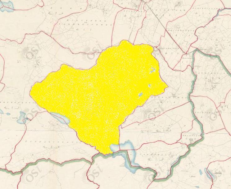
Size: 929 acres, 0 rods, 29 perchs
Siting:
In the eastern extremity of Kilcummin parish. Bounded on the east by Raha and Magherabeg, on the north by Gortrevagh, Ruahveala and Billymore/Carrowntober, on the west by Clooshgereen and on the south by Bunnagippaun and Buffy.
Description:
Land not good as it is subject to inundations from the mountains in winter. Contains 929 acres, 2/3 of which is under tillage, the remainder is boggy pasture. There is a school house near its centre and an old road passes through it. It contains 21¾ acres of water and 6 lakes (4 full lakes and portions of 2 others).
Placenames within townland:
Cruckawaghara / Barn Hill (hill) – A high hill with a triangulation station on it.
Kilgarriff (hill) – Translates to ‘rough wood’ (Coill Garbh). A very high hillock. It was once a burial ground but now tilled.
Ringfort 1 – On south-eastern slope of a hill. Poorly preserved subcircular cashel (26.6m in diameter) defined by a collapsed drystone wall.
Ringfort 2 – On north slope of a hill. Poorly preserved subcircular ringfort (23.6m in diameter) defined by a bank of earth and stone overlain from south to west by a modern field bank. A gap at east may be modern.
Quarry – Located by the side of the road at the border between Magheramore and Clooshgereen.
Lough Buffy – Translates to ‘lake of the yellow hut/tent’. A lough containing 37 acres of water in the parish of Kilcummin, the remainder is in Kilannin parish.
Previous proprietor/landlord:
Earl of Clanrickard (1641)
Earl of Clanrickard (1670)
Arthur French St. George of Tyrone House (1850)
Land Value (1857): £ 102 s.10 d. 0
Buildings Value (1857): £ 6 s.15 d. 0
Surnames attached to the townland (1857-1911):
Moloney, Faherty, Gavin, Rutledge, D’arcy, Welby, Gibbons, Logan, Fahy, Madden, Egan, Walsh, Clancy, Melia, Kelly


No Comments
Add a comment about this page