Shannawagh
Mary Kyne & Antoinette Lydon


Shaunawagh is in the civil parish of Kilcummin. The civil Parish corresponds with the following Church of Ireland parish of Kilcummin, Galway West. In general the civil parish and the Church of Ireland parish are the same as is the case in the Kilcummin Oughterard area.
The townland on the lakeshore lies west of Curraghduff West running along the lakeshore to Curraun Beg. It is arable in the eastern part with fine stone walls on sloping meadows which is likely what gives it its name.
Shannawagh is in the Electoral Division of Letterfore, in Civil Parish of Kilcummin, in the Barony of Moycullen, in the County of Galway
The Irish form of the name is Seana Mhach – old plain
Parish: Kilcummin
View all place names in this civil parish.
Description:
In 1850 according to the field notes recorded by John O Donovan for Griffith Land Valuation the land was described as very bad, wet and stony. Contains 100½ acres about the 1/3 of which is under tillage and pasture.
Situation:
In the northern part of the parish.
Shannawagh borders the following other townlands:
- Curraghduff West to the east
- Curraun Beg to the west
- Derroura to the south
Bounded on the N. by Lough Corrib.
Other forms of name.
Shannawagh
Seana Mhach
Sean a bhach
Shannawagh Boundary Surveyor
Shanavagha Barony Cess Book
Shanawaugh County Map
Shannawaugh Local
Shanavough Rector of Kilcummin
Shanavaugh
Other placenames in this townland:
Some other placenames in or near this townland are …
- Keelogue No. 1 (island)
- Keelogue No. 3 (island)
- Tootoge (rock)
Information
1641 This area was granted to the Earl of Clanrichard according to the Patent Rolls of James 1
Landlord
Proprietor Robert Martin, Ross. Robert was a member of the Martin’s of Ross family
Martin (Ross) – The Martin family were established beside Ross Lake in the barony of Moycullen, county Galway, from the late 16th century, where they purchased land from the O’Flahertys. They were Royalist supporters and were dispossessed of their property in the city of Galway by the Cromwellians. Robert Martin received a grant of 2,909 acres in the barony of Moycullen, by patent dated 21 Aug 1677. Jasper Martin of Ross, who died in 1700, had two sons Jasper and Richard, from whom descend the two branches of the family settled at Ross and Ballynahinch. Nicholas Martin, who died in 1811, married Elizabeth O’Hara, daughter of Robert O’Hara of Lenaboy, and according to Burke’s ”Landed Gentry”, a grandniece of James O’Hara, 2nd Baron Tyrawley. Their grandson, James Martin of Ross, had sixteen children from his two marriages. His daughter, Maud, married H. Callwell and they were the parents of the author, J. M. Callwell. The youngest daughter of James Martin was Violet Florence Martin of the well known literary team Somerville and Ross. The Martins of Ross owned 5,767 acres in county Galway in the 1870s. They advertised the sale of their estate in the Landed Estates’ Court in May 1885.
Martin (Ballynahinch) – A branch of the Anglo Norman family of Martin, one of the Tribes of Galway, was granted the O’Flaherty lands in the Connemara region in the mid 17th century. This family were a junior branch of the Martins of Ross and under the Acts of Settlement were granted vast estates in counties Galway, Mayo, Roscommon, Clare and Sligo. By a patent dated 1698 they were confirmed in the possession of their Connemara estate known as the Manor of Claremount by King William. The Westport Estate Papers document the sale of over 27,000 acres in the baronies of Moycullen and Ballynahinch by the trustees for the sale of Colonel John Browne’s estate to John Edwards for Richard Martin in 1699. The early generations of Martins lived at Birch Hall and Dangan, in the townland of Oranhill, parish of Rahoon, near Galway city. Richard Martin, better known as ‘Humanity Dick’, was the first member of the family to be reared as a Protestant. He was a famous duellist and founded the Society for the Prevention of Cruelty to Animals. Ballynahinch Castle was built in the centre of his estate. His son Thomas Martin died in 1847 during the Famine and Thomas’s only daughter and heir, Mary Laetita, inherited a heavily encumbered estate. She married her cousin, Arthur Gonne Bell, and died in New York in 1850. The Martin estates were offered for sale in two sections in 1849. Their property close to Galway town included Dangan, Corcullen, Bushypark and Killeen. Their Connemara estate was acquired by the Law Life Assurance Society in 1852, to whom it was heavily mortgaged. In 1853 the estate of almost 200,000 acres was surveyed by Thomas Colville Scott for a prospective buyer. Richard Martin, second son of Richard ‘Humanity Dick’ Martin of Ballynahinch, is recorded as holding five townlands in the parish of Killannin, barony of Moycullen, county Galway, at the time of Griffith’s Valuation although he emigrated to Canada in 1833. He was also recorded as the occupier of Clareville, a Martin home in the village of Oughterard. Many of his descendants still reside in Canada.
Information from the Down Survey Website:
The Down Survey is a mapped survey. Using the Civil Survey as a guide, teams of surveyors, mainly former soldiers, were sent out under Petty’s direction to measure every townland to be forfeited to soldiers and adventurers. The resulting maps, made at a scale of 40 perches to one inch (the modern equivalent of 1:50,000), were the first systematic mapping of a large area on such a scale attempted anywhere. The primary purpose of these maps was to record the boundaries of each townland and to calculate their areas with great precision. The maps are also rich in other detail showing churches, roads, rivers, castles, houses and fortifications. Most towns are represented pictorially and the cartouches, the decorative titles, of each map in many cases reflect a specific characteristic of each barony. (http://downsurvey.tcd.ie)
The Down Survey website will tell you who owned this townland in 1641 (pre Cromwell) and in 1671 (post Cromwell).
Townland of Shannawagh
Down Survey Name: Shanonveige 1641 Owner(s): Blake, Henry (Protestant) 1670 Owner(s): Bourke, Nicholas (Catholic); Jones, Sir Roger (Protestant) County: Galway Barony: Muckullin Parish: Killanine and Killcomyn Unprofitable land: 630 plantation acres Profitable land: 33 plantation acres Forfeited: 33 plantation acres
The Tithe Applotment Books
About the Records
Tithes were a tax on agricultural produce which was payable by the occupiers of agricultural land. They were the main source of income for the parish clergy of the Church of Ireland (the largest Protestant church and the church established by law). However, in many parishes a large part of the tithes were ‘appropriate’, which meant that they were payable to a bishop, cathedral chapter or other ecclesiastical recipient, or were ‘impropriate’, which generally meant that they were payable to a local landowner. The parishes used in the Tithe Applotment Books are civil or Church of Ireland parishes, which often differ in name and territory from Catholic parishes, Acts of Parliament of 1823 and 1832 provided for the conversion of tithes into a fixed charge on land, and specified the average price of wheat or oats in the parish in the seven years before 1821 as the basis on which the tithes would be calculated. They also extended the application of tithes to pasture, where previously they had been levied only on tillage.
This change in the law resulted in the valuation of individual holdings in almost all parishes containing agricultural land, in order to assess the portion of the tithes for which each occupier of land would be liable. The apportionment was recorded for each Church of Ireland parish in a Tithe Composition Applotment Book. The information was collected and two Parochial Commissioners calculated the amounts, one of who was appointed by the cess-payers of the parish and the other by the relevant Diocese of the Church of Ireland. This procedure was carried out in over 2,500 parishes between the years 1823 and 1837.
The Tithe Applotment Books are in a variety of formats, from a few pages sewn together to elaborately bound volumes. In most cases they are written in manuscript throughout, although some consist of manuscript entries on printed questionnaires. The information in the books is broadly uniform and generally includes at least the name of occupier, the size of holding, the valuation and the tithe payable. In some cases more detailed information is provided. Some volumes have maps and most have certificates and correspondence attached.
The sub-divisions of the parish were recorded. Some of these subdivisions, such as ploughlands, ceased to be in official use after the six-inch survey of the Ordnance Survey was completed in the 1840s. Only productive land was subject to tithe, and the books usually distinguish between this tithable land and untithable land such as roads or mountains. Tithable land was in some cases classified by quality, and a money value was given to each class. In some cases, the proportion of tithe payable to the rector, vicar or lay proprietor of the tithes was set out. The column for observations was sometimes completed, with information about commonage, for example.
There are a number of other points that should be noted. The acreages given in the Tithe Applotment Books are in Irish or Plantation measure, which is 1.62 times larger than statute measure. Only occupiers of land at the time of the tithe composition are recorded, so not all heads of households living in a parish at the time are included. Only rural areas are systematically covered, although inhabitants of towns who held plots of cultivable land are included. The equivalent tax in urban areas, Minister’s Money, has left few records.
The Tithe Applotment Books are an important source of information for a wide variety of researchers of pre-Famine Ireland. They provide the first surviving national list of the occupiers of land, and are used by genealogists as a partial substitute for returns of the 1821 and 1831 censuses of population, which were destroyed in 1922. They also record information on the quality of land, and provide information on pre-Ordnance Survey territorial divisions, some of which were not recognised after the 1840s.
The National Archives hold the original Tithe Applotment Books only for the twenty-six counties of the Republic of Ireland. The books for the six counties of Northern Ireland are held in the Public Record Office of Northern Ireland in Belfast. http://titheapplotmentbooks.nationalarchives.ie/search/tab/aboutmore.jsp
Henry Joyce had 86 acres; 8 acres 2nd quality with a payment of 1s, 4 acres 3rd quality with a payment of 3d, 4 acres of 4th quality land with a payment of ½d & 70 acres of 5th quality land with a payment of ⅛d.
The Tithes payments went to Richard Martin Esq. James Daly & the Reverend John Wilson.
http://titheapplotmentbooks.nationalarchives.ie/reels/tab//004587459/004587459_00445.pdf
Griffiths Valuation 1850’s
In Griffith’s Valuation the area is 100acres 2roods 1perch with a land value of £10 10s 0d. Value of Building is £1 10s 0d, and the total value is £12.
Occupiers of the Land:The land was farmed or herded by Patrick Mullen, Hugh Mullen and Patrick Joyce
Landlord was William D. Griffith who leased the land.
Ownership of Land and Property
The three families owned a house, outhouse and land.
Annual Valuation
Land valuation for each family was £3 10.eachand for their buildings they were rated 10s each.
http://www.askaboutireland.ie/griffith-valuation/index.xml?action=doNameSearch&PlaceID=559067
Offices and Land
The out office was a farm building, a cow house, piggery or barn. The land was very poor and sterile and people were always poverty-stricken. At this time most tenants were trying to eke out a living on 5acres or less and a farmers needed at least 15.3 acres to survive.
Clachan: The Irish is ‘Clochán’. The houses in Shannawagh formed a Clachan. A clachan was a small traditional settlement common in Ireland until the middle of the 20th century. They usually lacked a church, post office or other formal building. The origin is unknown but it is likely that they are of ancient root most likely dating to medieval times.
The Shannawagh clachan was a cluster of small single storey farmers’ cottages built on poor land. They were related to the rundale system of farming. According to David Lloyd, The Great Famine 1845–1849 caused such disruption to the social system that the clachans virtually disappeared.
People living in Clachans had the support of a tight knit community.
In some cases the clachans have evolved into holiday villages or one or two houses have been taken over turning smaller houses into agricultural outhouses.
Poor Law Union Ireland
In Ireland the Poor Relief Act of 1838 divided into districts or “unions” in which the local taxable inhabitants were to be financially responsible for all paupers in the area. In 1898 the Poor Law Union was adopted as the basic administrative division in place of the civil parish and barony. Further subdivision into 828 registration districts and 3,751 district electoral divisions followed. Townlands were not arranged according to these divisions with parish and barony retained as a means to make comparisons with records gathered before 1898.
The 1838 Act
The main provisions of the 1838 Act were:
- The extension of the existing Poor Law Commissioners’ powers to Ireland, with the appointment of Assistant Commissioners who were to implement the Act in Ireland.
- The division of the country into Poor Law Unions based on Irish electoral divisions which were themselves made up from townlands.
- The creation of a Board of Guardians for each Union, two-thirds of whom were to be elected, the other third to be appointed ex officio.
- The setting up of a workhouse in each Union.
- The collection of a local poor-rate to finance the system.
- Assistance for emigration.
Initially, 130 Unions were created, based upon 2,049 electoral divisions. The divisions were composed of townlands, a peculiarly Irish unit, traditionally of 120 Irish acres in area. (Between 1848 and 1850, an additional 33 Unions were created by subdividing and reorganizing the boundaries of some existing Unions, particularly in the west of the country.
Boards of Guardians were elected annually on 25th March. Only rate-payers were eligible for election, which effectively disenfranchised most of the native Irish who were usually tenants at this time. Rate-payers were allowed between one and six votes depending on the size of a valuation of their property.
Townlands
A town land is one of the smallest land divisions in Ireland. They range in size from a few acres to thousands of acres. Many are Gaelic in origin, but some came into existence after the Norman invasion 1169. Shannawagh is a townland.
Population & Census Information
People who lived here:
You can retrieve a list of people who lived in this townland from 1827 to 1911. This list is compiled from the following resources.
- The Tithe Applotment Books
- Griffith’s Valuation
- 1901 Census
- 1911 Census
List of nineteenth century and early twentieth century inhabitants.
1841-1891 Census
1841 – 5 houses with 31 people
1851 – 4 houses with 19 people
1861 – 6 houses with 29 people
1871 – 4 houses with 19 people
1881 – 3 houses (3 inhabited) with 17 people (7 males / 10 females). There were 3 outbuildings. Total Valuation of Houses & Lands £12 0s 0d.
1891 – 3 houses (3 inhabited) with 17 people (8 males / 9 females). There were 6 Outbuildings. Total Valuation of Houses & Lands £12 0s 0d.
1901 Census Shannawagh
This is a return of the members of the family, visitors, boarders or servants who slept or abode in their house on the night of Sunday March 31st 1901 in Shannawagh.
There were 3 houses listed in the Townland of Shannawagh. The people were all Roman Catholics – 8 males and 7 females a total of 15 persons and they were born in County Galway. There were 6 in total of farm buildings and out offices which included, cow houses, and piggeries.
Class of House: The class of house depended on the materials used in the roof, walls, number of rooms and number of front windows. A 1st class house was considered the highest standard.
Walls of the houses: The walls were of stone, brick, concrete or of mud, wood or other perishable material. The houses in Shannawagh were built of stone, brick or concrete. There were no mud cabins.
Landholder of the property unless otherwise stated was the lawful owner.
Roofs were of slate, iron, tiles, thatch, wood or other perishable material. The roofs of houses were of thatch, wood or perishable material. Most likely they were thatched as there was ample reeds for thatching in the lakes.
House Occupancy: Each of the 3 houses was occupied by one family.
The people listed as Head of the Family were also listed as the lawful Landholder of the property
Enumerators Extract
http://www.census.nationalarchives.ie/reels/nai000840434/
House & Building Return
http://www.census.nationalarchives.ie/reels/nai000840435/
Out Office & Farm Steadings
http://www.census.nationalarchives.ie/reels/nai000840436/
House 1: Timothy Mullen a farmer aged 37 was head of the family and lived with his wife Annie 34, daughter Nellie 11 – a scholar. The family could read and write and they spoke Irish and English. They lived in a Class 3 house with 1 front window. 3 persons occupied 2 rooms. They had a cowhouse and a piggery.
http://www.census.nationalarchives.ie/pages/1901/Galway/Letterfore/Shannaivagh/1394514/
House 2: Margaret Mullen aged 34 was head of the family. Her children Stephen 12, Mary 10, Bridget 9, Hugh 7, Margaret 5, John 3 and Patrick 1 lived with her. They lived in a class 3 house with 2 front windows. 8 persons occupied 2 rooms. They had a cow house and a piggery.
http://www.census.nationalarchives.ie/pages/1901/Galway/Letterfore/Shannaivagh/1394515/
House 3: Michael Joyce a farmer aged 65 lived with his wife Honor 62 and their son Thomas 13 – a scholar. Peter Joyce a nephew aged 35, a bricklayer lived with them. He was single. Michael, Honor or Peter didn’t read or write but they spoke Irish and English. They lived in a Class 3 house with 2 front windows.4 persons occupied 2 rooms. They had a cow house and a piggery.
http://www.census.nationalarchives.ie/pages/1901/Galway/Letterfore/Shannaivagh/1394516/
Shannawagh Census 1911
This is a return of the Members of families in Shannagh, their visitors, boarders and servants who slept or abode in the house on the night of Sunday the 2nd of April 1911.
Description of the Houses
All the houses in Shannagh were listed as private dwellings and were built of concrete or stone. The roofs of the houses were of wood, thatch or other perishable material. Most likely they were thatched. The head of the family were listed as the landholders. One family lived in each property. The Class of the house depended on the material used in the roof, walls, number of rooms and number of front windows. Most of the houses came under “2’ in the census form meaning that there could be 2, 3, or 4, rooms in the house. There were 6 males and 7 females living in the townland. They had 4 farm buildings.
Enumerators Extract
http://www.census.nationalarchives.ie/reels/nai002435064/
House & Building Return
http://www.census.nationalarchives.ie/reels/nai002435066/
Out Office & Farm Steadings
http://www.census.nationalarchives.ie/reels/nai002435068/
House 1: Matthew Mullen a farmer aged 54 was head of the family. He lived with his wife Margaret 44 and their children – Hugh 17, Margaret 15, John 13, Patrick 11, Martin 8, Barbara 6 and Annie 3. Monica Moloney aged 86 a widow and a lodger lived with them in a Class 2 house with 3 front windows. 10 people occupied 2 rooms. The family could read and write and they spoke Irish and English. Monica didn’t read or write. Matthew and Margaret were married 23 years and they had 11 children born alive and 10 were still living.
The Matt and Margaret lived here until they died in their thirties. Tommy Joyce bought the house and farm in 1948 from their son Pat who was a sergeant in Cork. Tommy Joyce was Paul’s father. Jack and Miriam Vard from Dublin bought the old Mullen house and built a holiday home there in 1958. The family still owns the house.
http://www.census.nationalarchives.ie/pages/1911/Galway/Letterfore/Shannawagh/912207/
House 2: Michael Joyce a farmer aged 73 was head of the family. He lived with his wife Honor aged 73 and they didn’t read or write and daughter Agnes 25 who was single and could read and write. The family spoke Irish and English. They were married 44 years and 8 children were born alive and 6 were still living. They lived in a Class 2 house with 3 front windows. 3 people occupied 2 rooms.
http://www.census.nationalarchives.ie/pages/1911/Galway/Letterfore/Shannawagh/912208/
Tommy Joyce son of Michael and Honor returned from England in 1916 to work the farm. He married Florence Lyons in 1919 and they had 9 in family – Mary, Honor, Stephen, Michael, Paul, Theresa, Paddy, Tom and Joe.
Currently Paul and Peg live there with six in family – Tom. Margaret, Florence, Gerard. Pauline and Josephine. 4 members of the family have built homes there – Gerard and Sandra Deacy (Galway),with their boys Paul and Shane, Margaret and Michael Mullally and their girls Aisling and Roisin and next along the road are the homes of Florence and Pauline.
Donal and Connie Connolly run and angling guest house called Nonaim Fishing Lodge. Anglers from far and near come to fish and relax here with Donal and Connie and enjoy their hospitality and cuisine.
In 2013; The other house in the townland which is thatched is owned by Nora Ann Mullderrig.
House 3: Timothy Mullen: This house was uninhabited and was owned by Timothy Mullen. It was a Class 2 house with 3 front windows.
http://www.census.nationalarchives.ie/reels/nai002435066/
Church records of births, deaths and marriages:
Church records of births, deaths and marriages are available online at http://www.rootsireland.ie. To search these records you will need to know the ‘church parish’ rather than the ‘civil parish’. (The civil parish is the pre-reformation parish and was frequently used as a unit of administration in the past.
Shannawagh is in the civil parish of Kilcummin.
Catholic parish:
This civil parish corresponds with the following Roman Catholic parish or parishes.
- Clonbern & Kilkerrin in Galway East.
- Carraroe in Galway West.
- Kilannin in Galway West.
- Kilcummin/Oughterard in Galway West.
- Rosmuc in Galway West.
Church of Ireland parish:
This civil parish corresponds with the following Church of Ireland parish.
- Kilcummin in Galway West
In general, the civil parish and the Church of Ireland parish are the same, but, this is not always the case.
Maps
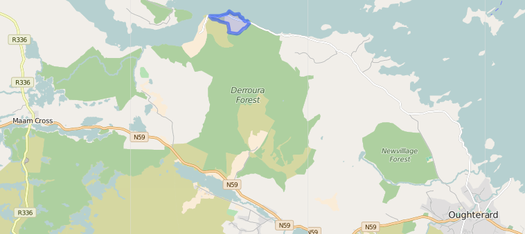
It is located at 53° 29′ 5″ N, 9° 26′ 30″ W
Original OS map of this area
Ireland was first mapped in the 1840s. These original maps are available online.
Shannawagh
Original OS maps at the Ordnance Survey of Ireland website
Below is a link to the Ordnance Survey of Ireland website. It displays the original OS map that was created in the 1840s.
Shannawagh
Information from Google Maps:
You can use this link to find this townland on Google Maps.
Information from the National Monuments Service:
You can use this link to view a map of archaeological features. This link brings you to a website wherein you will have to search for your townland.
Archaeological map from the National Monuments Service
Galway Library Website
http://places.galwaylibrary.ie/asp/fullresult.asp?id=53125
Townlands.ie Website
https://www.townlands.ie/galway/moycullen/kilcummin/letterfore/shannawagh/


No Comments
Add a comment about this page