Glebe
Antoinette Lydon

Glebe is in the civil parish of Kilcummin. The civil Parish corresponds with the following Church of Ireland parish of Kilcummin, Galway West. In general the civil parish and the Church of Ireland parish are the same as is the case in the Kilcummin Oughterard area.
Irish Form of Name: Gléib
Other Forms of the Name:
Glebe
Glebe Boundary Surveyor
Glebe Land Barony Cess Book
Glebe Local
Area:
Glebe contains 37½ acres all arable with the exception of about 14 acres of bog, the Glebe House situate in the eastern extremity of the townland. There is an old fort and quarry situate close to its northern boundary.
Boundries:
Glebe borders the following other townlands:
- Carrowntober to the west
- Lemonfield to the north
- Rushveala to the east
COUNTY Gaillimh/Galway
ELECTORAL DISTRICT Uachtar Ard/Oughterard
BARONY Maigh Cuilinn/Moycullen
CIVIL PARISH Cill Chuimín/Kilcummin
TOWNLAND An Ghléib/Glebe
Landlords:
Richard Martin (1670)
Earl of Clanrickard (1670)
Rev. J. Wilson, Rector (c. 1850)
Rev. John Wilson 1806-1844 was appointed as Perpetual Curate to the parish of Kilcummin 1806. One acre of land was acquired from Arthur St. George from Tyrone, Galway for the nominal sum of 10 shillings.
Down’s Survey:
Townland of GLEBE (Moycullen By)
Down Survey Name: Mountain
1670 Owner(s): Martin, Richard (Catholic); Clanrickard, Earl of (Protestant)
County: Galway
Barony: Muckullin
Parish: Killcumyn
Tithe Applotment Books 1829
No information listed for Glebe
Griffith’s Valuation 1850’s:
In Griffith’s valuation the area was 37 acres, 2 rood & 9 perch with a land value £18 10s 0d. Value of Buildings was £7 0s & 0d. Total valuation of £25 10s 0d.
Occupier of Land
Rev. John O’Callaghan, John Lynn
Immediate Lessor
George F. O’Flahertie
Rev. John O’Callaghan
http://www.askaboutireland.ie/griffith-valuation/index.xml?action=doNameSearch&PlaceID=560014
Poor Law Union Ireland
In Ireland the Poor Relief Act of 1838 divided into districts or “unions” in which the local taxable inhabitants were to be financially responsible for all paupers in the area. In 1898 the Poor Law Union was adopted as the basic administrative division in place of the civil parish and barony. Further subdivision into 828 registration districts and 3,751 district electoral divisions followed. Townlands were not arranged according to these divisions with parish and barony retained as a means to make comparisons with records gathered before 1898.
The 1838 Act
The main provisions of the 1838 Act were:
- The extension of the existing Poor Law Commissioners’ powers to Ireland, with the appointment of Assistant Commissioners who were to implement the Act in Ireland.
- The division of the country into Poor Law Unions based on Irish electoral divisions which were they made up from townlands.
- The creation of a Board of Guardians for each Union, two-thirds of whom were to be elected, the other third to be appointed ex officio.
- The setting up of a workhouse in each Union.
- The collection of a local poor-rate to finance the system.
- Assistance for emigration.
Initially, 130 Unions were created, based upon 2,049 electoral divisions. The divisions were composed of townlands, a peculiarly Irish unit, traditionally of 120 Irish acres in area. (Between 1848 and 1850, an additional 33 Unions were created by subdividing and reorganizing the boundaries of some existing Unions, particularly in the west of the country.
Boards of Guardians were elected annually on 25th March. Only rate-payers were eligible for election, which effectively disenfranchised most of the native Irish who were usually tenants at this time. Rate-payers were allowed between one and six votes depending on the size of a valuation of their property.
Townlands
A town land is one of the smallest land divisions in Ireland. They range in size from a few acres to thousands of acres. Many are Gaelic in origin, but some came into existence after the Norman invasion 1169. Glebe is a townland.
Population & Census Information
You can retrieve a list of people who lived in this townland from 1827 to 1911. This list is compiled from the following resources.
- The Tithe Applotment Books
- Griffith’s Valuation
- 1901 Census
- 1911 Census
List of nineteenth century and early twentieth century inhabitants.
Census 1841-1891
1841 – 3 houses with 16 people
1851 – 1 houses with 6 people
1861 – 2 houses with 5 people
1871 – 2 houses with 13 people
1881 – 2 houses 14 people (5 males & 9 females), both house inhabited. There was 11 Outbuildings. Total Valuation of Houses & Lands £28 10s 0d.
1891 – 2 houses 9 people (4 males & 5 females). There was 5 Outbuildings. Total Valuation of Houses & Lands £28 10s 0d.
Census 1901 Glebe
This is a return of the member of the family, their Visitors, Boarders, and Servants who slept or abode in their house on the night of 31st of March 1901 in Glebe. There was 1 house listed in the townland of Glebe. 5 (2 females/ 3 males) were all Roman Catholics.
There were a total of 2 farm buildings and out offices which included a piggery & a cow house.
(All documents are damaged, see links below).
Enumerators Extract
http://www.census.nationalarchives.ie/reels/nai000840739/
House & Building Returns
http://www.census.nationalarchives.ie/reels/nai000840740/
Out Offices & Farm Steadings
http://www.census.nationalarchives.ie/reels/nai000840741/
Class of House: The class of house depended on the materials used in the roof, walls, number of rooms and number of front windows. A 1st class house was considered the highest standard.
Walls of the houses: The walls were of stone, brick, and concrete or of mud, wood or other perishable material. The house in Glebe was built of stone, brick or concrete. There were no mud cabins.
House 1
Document severely torn – see hyperlink below.
?? Conneely aged 95 was head of the household; married to ?? aged 60; they lived with their son name illegible aged 23, daughter name illegible aged 20 & servant first name illegible Conneely aged 10.
The head of the family was a herd; the son a herd’s son; the daughter a herd’s daughter. None of the family could read. Due to the fact that the return form was torn, there is a ? entered for whether they spoke Irish or English or both.
They lived in a 3rd class house with 2 rooms and 1 front window. They had a piggery and a cow house. This premise was a Private Dwelling.
http://www.census.nationalarchives.ie/pages/1901/Galway/Oughterard/Glebe/1394652/
Census 1911 – Glebe
This is a return of the Members of the families in Glebe, their visitors, boarders and servants who slept or abode in the house on the night of Sunday 2nd April 1911.
There were 2 houses listed in the Townland of Glebe. Of the people living in Glebe all 4(1 male/3 females) 1 was Roman Catholic & 3 Protestant Episcopalian.
People that lived in Glebe were born included Dublin City, Co. Waterford, Co. Galway & England. There were a total of 4 farm buildings and out offices which included a stable, coach house, barn and a shed.
Enumerators Extract
http://www.census.nationalarchives.ie/reels/nai002435541/
House & Buildings Returns
http://www.census.nationalarchives.ie/reels/nai002435543/
Out Offices & Farm Steadings
http://www.census.nationalarchives.ie/reels/nai002435545/
House 1
Joseph S Dyner White aged 43 was head of the family; married to Edith Hungerford White aged 46; they lived with Mary Gavin aged 20, single.
Joseph was a Clerk in the Holy Orders Rector; and Mary Gavin was a domestic servant. Joseph, Edith & Mary could read & write. Joseph was born in Dublin City, Edith was born in Co. Waterford and Mary was born in Co. Galway. Joseph & Edith were Protestant Episcopalian and Mary was Roman Catholic.
They lived in a 1st class house with 4 rooms and 8 front windows. They had a stable, coach house, a barn and a shed. This premise was a Private Dwelling.
Joseph and Edith were married for 17 years; they had 2 children; both living at the time of the census.
2 entries were crossed out on the return. Francis ? White, son aged 16 & Rachel Margaret White, daughter aged 14. They were scholars and both were born in Cork.
http://www.census.nationalarchives.ie/reels/nai002435547/
House 2
Elizabeth Gallagher aged 70 was head of the family; she was married and lived alone. She was a dressmaker; could read and write. She was married for 22 years and did not have children. She was Protestant Episcopalian.
Elizabeth lived in a 2nd class house with 2 rooms and 2 front windows. She had no out buildings. This premise was a Private Dwelling.
As per Enumerator’s abstract (Form N)
There were 2 houses in the townland of Glebe with a total of 4 people living in the townland; 3 females and one male; One Roman Catholic and Three Protestant Episcopalian.
http://www.census.nationalarchives.ie/reels/nai000840739/
Out Offices and Land
The out office was a farm building, a cow house, piggery or barn. The land was very poor and sterile and people were always poverty-stricken. At this time most tenants were trying to eke out a living on 5 acres or less and a farmer needed at least 15.3 acres to survive.
Church records of births, deaths and marriages:
Church records of births, deaths and marriages are available online at http://www.rootsireland.ie. To search these records you will need to know the ‘church parish’ rather than the ‘civil parish’. (The civil parish is the pre-reformation parish and was frequently used as a unit of administration in the past.)
Glebe is in the civil parish of Kilcummin.
Catholic parish:
This civil parish corresponds with the following Roman Catholic parish or parishes.
- Clonbern & Kilkerrin in Galway East.
- Carraroe in Galway West.
- Kilannin in Galway West.
- Kilcummin/Oughterard in Galway West.
- Rosmuc in Galway West.
Church of Ireland parish:
This civil parish corresponds with the following Church of Ireland parish.
- Kilcummin in Galway West.
In general, the civil parish and the Church of Ireland parish are the same, but, this is not always the case.
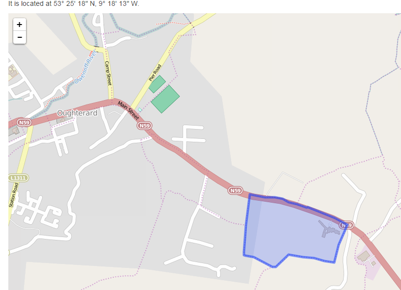
Map:
It is located at 53° 25′ 18″ N, 9° 18′ 13″ W.
Ireland was first mapped in the 1840s. These original maps are available online.
Below is a link to the Ordnance Survey of Ireland website. It displays the original OS map that was created in the 1840s.
Information from Google Maps:
Glebe
You can use this link to find this townland on Google Maps.
Information from the National Monuments Service:
You can use this link to view a map of archaeological features. This link brings you to a website wherein you will have to search for your townland.
Archaeological map from the National Monuments Service
(this site will display in a new window)
Information from the Logainm database:
View Logainm information;
this information will display in a new window:
http://www.townlands.ie/galway/moycullen/kilcummin/oughterard-ed/glebe/
http://places.galwaylibrary.ie/asp/fullresult.asp?id=52398


No Comments
Add a comment about this page